Description
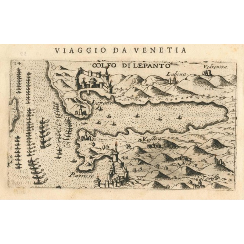
Golfo di Lepanto. Venice: Giacomo Franco, 1598. 100 x 175mm. An early map of the Gulf of Corinth with the defensive walls of Nafpaktos shown in relief. At the mouth of the gulf is a fleet of galleys, probably referring to the Battle of Lepanto, 1571. It was published in Rosaccio’s ‘Viaggio da Venetia a Costantinopoli’. Additional informationDimensions175 100 mmCartographerROSACCIO, Giuseppe.Date1598Extra InfoGolfo di Lepanto.PublicationVenice: Giacomo Franco, 1598. 100 x 175mm.ConditionA good example.References
| Year | 1598 |
|---|---|
| Production Period | Before 2010 |
| Style | Vintage |
| Detailed Condition |
Good This vintage/antique item may have some wear such as scratches and other signs of ageing. |
| Product Code | ZHV-2107046 |
| Materials | Paper |
| Color | Beige |
| Weight Range | Standard Between 40kg and 80kg |
| Duties Notice | Import duty is not included in the prices you see online. You may have to pay import duties upon receipt of your order. |

Reviews
There are no reviews yet.